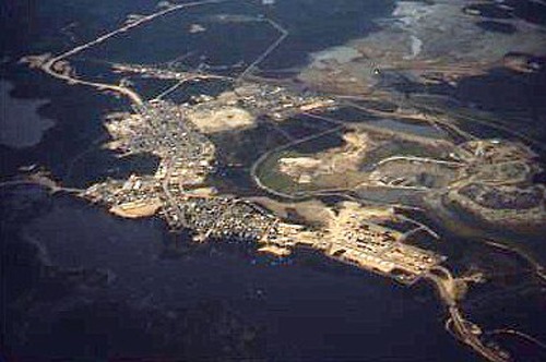
Sherritt Gordon's open pit mine/ Lynn Lake MB
Overhead view from west to east of Lynn Lake MB and Sherritt Gordon's 2 primary mine sites (summer 1970).
Overhead view from west to east of Lynn Lake,MB Sherritt Gordon's 2 primary mine sites from CALM Air (Found Bros Aircraft/FBA-2C) CF-SOP . Dark foreground = West Lynn Lake ; bottom right is road to Eldon Lake float planes' base ,far upper right is the then new gravel road north then south-east 185 miles/322km to Thompson,MB . In between is crescent shaped Lynn Lake townsite. Centre right is the Farley mine site showing tailings ponds , the unused open pit , the mine headframe . Mid centre left is Sherritt's A Mine with head frame and operating bldgs. Upper right third are the then current tailings ponds. I think the cleaner water eventualy drained in to Eldon Lake? (Summer 1970)